DISCLAIMER: The following discussion describes recent atmospheric
trends and how they may interrelate to a past historical event. *This is not a forecast* The model data trends
being shared are used for amateur interpolations.
Today marks the ides of the 24th anniversary of some of March's
greatest weather impacts on record. Now
we're not expecting the intensity from that monster storm, but the current
evolution of the upper atmosphere from operational weather models do appear to somewhat
resemble the evolution.
Two areas of atmospheric energy are modeled to interact and eventually phase over the Atlantic Ocean. One piece of the northern polar jet stream is modeled to dive south from out of the Pacific Northwest and Northern Great Plains while a small system from the subtropical jet stream initially over Mexico develops over the warm Gulf of Mexico. The two jet streams are modeled to eventually interact and develop a phased storm system off the East coast of the U.S.
Afternoon European ensemble model upper atmosphere simulation from TropicalTidBits.com

The March 1993 storm of last century experienced some of
the lowest atmospheric pressure levels for several cities and became one of the
strongest winter storms on record. It's
highly unlikely that March 14, 2017 will produce a storm of such extreme
intensity, but some of the threatening weather from that day 24 years ago should be anticipated.
Here is an animation of what the atmospheric flow from March 1993 produced from an excellent NOAA report of the storm.

SNOWFALL
The weather models have been having difficulties with how
the rain/snow line orientation will shift during the storm tomorrow night into
Tuesday March 12, 2017. The D.C. metro
areas could be at risk for precipitation briefly switching from snow to sleet
and possibly rain for a time. In such a
scenario localized snowfall would not be as deep. A changeover to mixed precipitation has happened
before with big D.C. area snow storms,
so it's not all that uncommon to see.
The animation below shows a
simulation of precipitation from the afternoon run of the high
resolution 3 kilometer Nest North American Model (3km NAM) from TropicalTidBits.com

Here is a similar simulation from the Global Forecast System (GFS) Model from TropicalTidBits.com
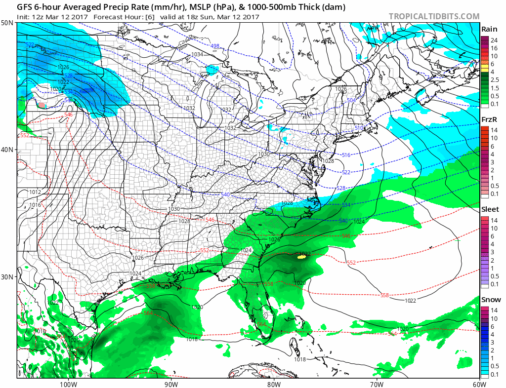
Here is what the Global Forecast System (GFS) Model has been trending
towards over the last 24 hours in terms of snowfall from TropicalTidBits.com.
Notice the trend similarities!

Storm
Placement and Track
The following animation of images were compiled from weather model data sites TropicalTidBits.com and NOAA's NCEP data server showing sea level pressure and precipitation snapshot
trends off the Virginia coastline.

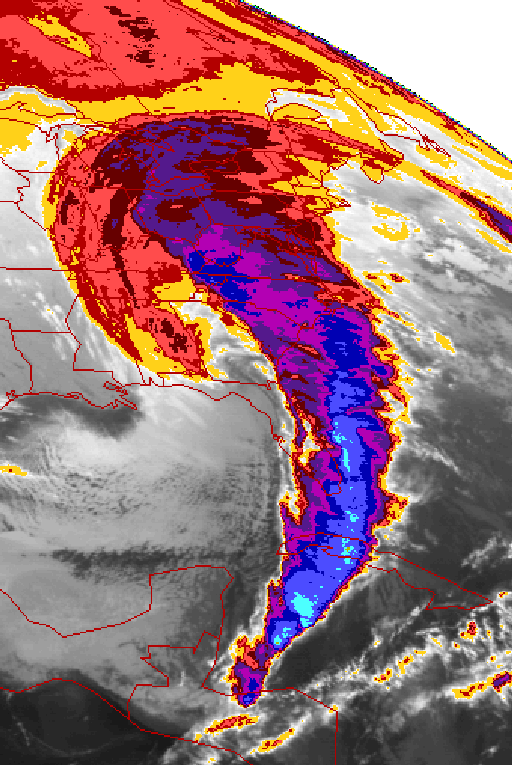
Meteorologists amateur and pro now know the March 1993 storm
by name. It deepened explosively along
its journey over the Eastern seaboard and left behind some of the most
remarkable textbook satellite imagery as such from Wikimedia commons.
The models all unanimously show a
high impact winter storm that will be riding up the coast with heavy snows from
parts of Virginia to Maine over the next couple days. This one will likely not be quite as bad as 1993, but uncertainty in model trends are still unusually high just a day prior to the storm's development. Stay tuned to your local forecasts at www.weather.gov/(enter zip code)
No comments:
Post a Comment